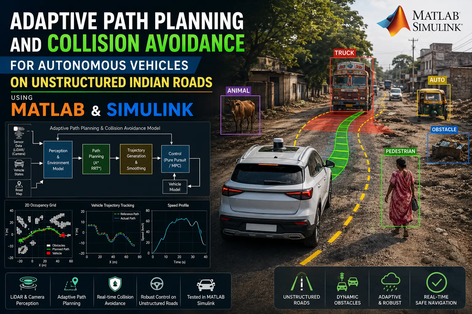
What is Adaptive Path Planning and Collision Avoidance for Autonomous Vehicles on Unstructured Indian Roads?
Adaptive Path Planning and Collision Avoidance for Autonomous Vehicles on Unstructured Indian Roads is a MATLAB-based technical project and simulation model. Most autonomous vehicle architectures rely on structured infrastructure: visible lane boundaries, standard regulatory signage, predictable right-of-way rules, and signalized intersections. Indian roads rarely meet these criteria. Passenger cars share the physical roadway with buses, auto-rickshaws, commercial trucks, two-wheelers, bicycles, pushcarts, pedestrians, and domestic animals. Drivers frequently merge without indicators, travel against the flow, and weave across unmarked road segments to avoid potholes or broken shoulders. Pedestrians and animals cross at arbitrary points rather than designated crosswalks.
Project Methodology
The system architecture is structured into perception, short-term motion forecasting, behavioral decision logic, local path generation, and vehicle execution. The complete pipeline is developed and evaluated using MathWorks simulation tools.
Perception and sensor fusion
The platform models a synchronized multi-sensor array combining camera, LiDAR, and radar subsystems using Automated Driving Toolbox. Camera streams supply rich semantic information, LiDAR point clouds provide direct spatial geometry and ground-plane extraction, and radar units deliver reliable relative velocities. Detections from these modalities are fused into tracked object tracks. A deep learning pipeline built with Deep Learning Toolbox classifies detected objects into operational categories, with specific models trained to distinguish auto-rickshaws, pushcarts, two-wheelers, pedestrians, and animals from standard automotive traffic.
Non-lane-based trajectory prediction
Because road users on unstructured roads do not adhere to fixed lanes, the prediction module cannot rely on lane-association models. Instead, trajectory predictors in Deep Learning Toolbox track the recent kinematics of surrounding entities. The model outputs short-horizon probability distributions of future positions for each agent. This enables the planner to anticipate informal merges, swerves around potholes, and sudden pedestrian movements before they intersect the ego-vehicle's path.
Behavioral decision-making and path planning
Planning operates as a two-stage hierarchy:
- Decision logic: A Stateflow state machine coordinates the behavioral mode of the vehicle. It evaluates clearance, relative approach rates, and drivable surface limits to switch between states such as corridor following, lateral nudging around slow-moving pushcarts, informal lane merging, and emergency stopping.
- Path generation: Using planners from Navigation Toolbox, the system calculates candidate trajectories over the obstacle-free drivable area. The cost function penalizes proximity to dynamic obstacles, path curvature changes, and proximity to road edges. When a pedestrian steps into the road or an animal blocks the trajectory, the planner recomputes a safe, kinematically feasible route within millisecond intervals.
Vehicle dynamics modeling
Path tracking commands feed into either a Simulink non-linear bicycle model or a multi-degree-of-freedom chassis model from Vehicle Dynamics Blockset. Low-level controllers translate the desired trajectory into steering angle, throttle position, and brake pressure while respecting physical tire-road friction limits.
Scenario construction and validation
The complete autonomous stack is validated in MathWorks RoadRunner against five realistic test cases reflecting Indian driving conditions:
- An unmarked village road featuring undefined road edges, rough shoulder transitions, and potholes.
- An unsignalized urban intersection where multiple vehicle types merge and cross simultaneously without formal right-of-way priority.
- A highway merge scenario where high-speed traffic must integrate around slow tractors, auto-rickshaws, and utility carts.
- A crowded market corridor characterized by tight lateral clearances, high pedestrian density, and stationary pushcarts.
- An unexpected cattle-crossing scenario on an open roadway that tests mid-trajectory replanning and emergency stopping.
Verified MATLAB Simulation Code Demonstration
Syntax-highlighted executable code demonstration for Adaptive Path Planning and Collision Avoidance for Autonomous Vehicles on Unstructured Indian Roads:
% MATLAB Constrained Numerical Optimization
clc; clear; close all;

obj_fun = @(x) (x(1)-2)^2 + (x(2)-3)^2;
x0 = [0, 0]; A = [1, 2]; b = 4; lb = [0, 0];

options = optimoptions('fmincon', 'Display', 'off', 'Algorithm', 'sqp');
[x_opt, fval] = fmincon(obj_fun, x0, A, b, [], [], lb, [], [], options);

fprintf('Optimization Solved: Minimum Value = %.4f\n', fval);